Protecting the Waters of The Great Lakes
Green Bay National Estuarine Research Reserve Under Review
The Great Lakes will likely get another protected area established soon – the Green Bay National Estuarine Research Reserve (GB NERR). Final decisions about designation are under review by the National Oceanic and Atmospheric Administration (NOAA), a process that could take 12 to 24 months.
This is the third marine preserve being considered within the Great Lakes. Portions of both Lake Erie and Lake Ontario are under similar review. These areas draw special attention because of their unique and fragile environmental and ecosystem characteristics. A protected status can help preserve those attributes. Importantly, sanctuaries and reserves don’t end up as fenced-off territory. To the contrary their value increases for research, education and even tourism.
Proposed Sites
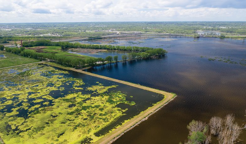
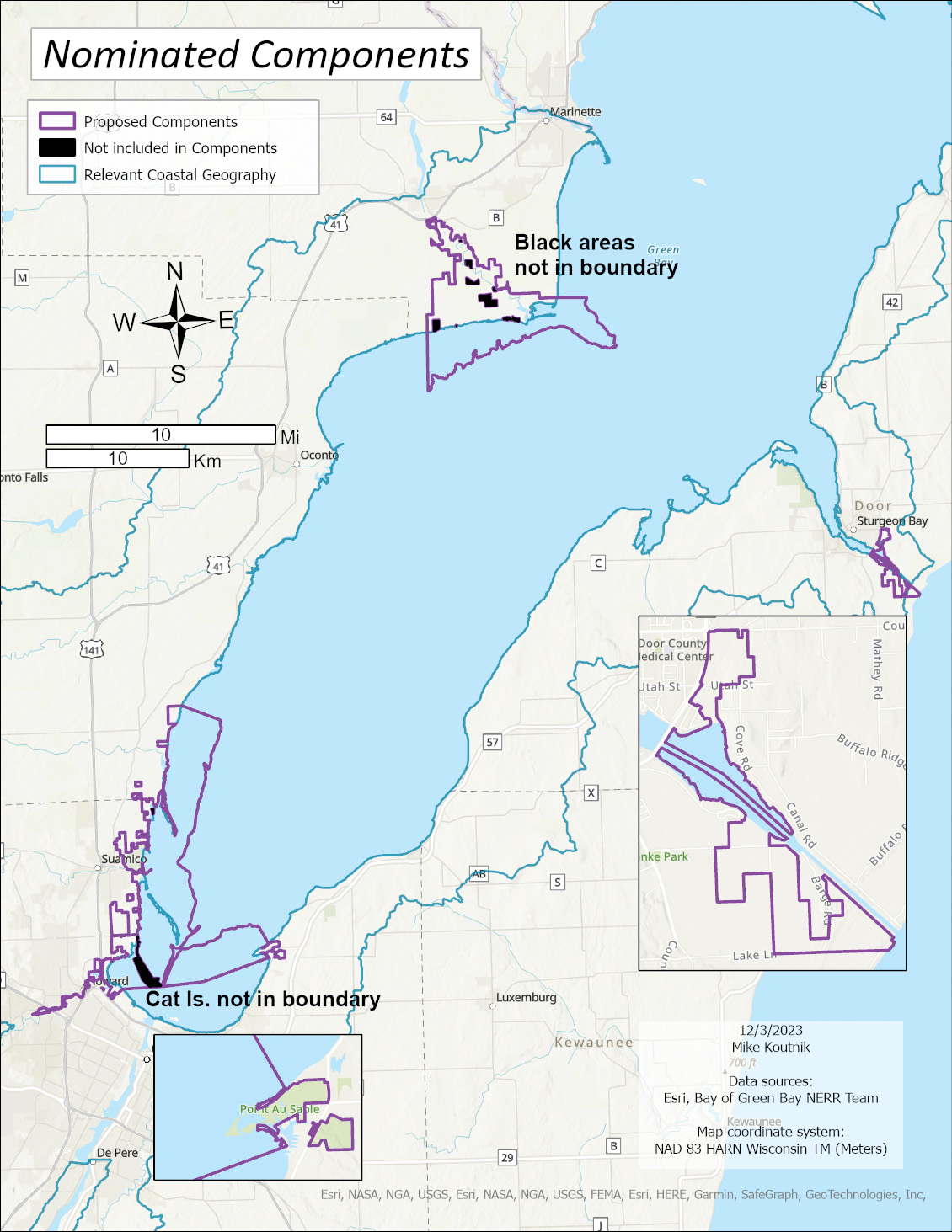
The newest proposed reserve consists of three sites within Green Bay–Peshtigo River, Lower Bay and Sturgeon Bay. The Peshtigo River complex is owned and managed by the Wisconsin Department of Natural Resources. Emily Tyner, director of freshwater strategy at University of Wisconsin – Green Bay (UWGB) and designation project leader, said public ownership is important since designation proceeds with an overall sense of public benefit. Additionally, the site is what she called “a relatively natural” Great Lakes estuary system, with a meandering river, no harbor development and an estuary mouth into the Bay. The western shore includes a gradient from undisturbed to managed. “At Peshtigo there has not been a need for extensive restoration, and it includes some of the last remaining wetland complexes on Green Bay,” Tyner said.
The Lower Bay complex is controlled by several public partners, including DNR and local jurisdictions. This area has been restored over the years, work which is still ongoing. Tyner said most of these lands are within an area called the “Lower Green Bay Area of Concern,” one of several degraded Great Lakes regions that has drawn focused state and local remedial efforts. The area’s ongoing recovery is important to maintain.
Sturgeon Bay includes public areas that represent east shore water circulation patterns and smaller watersheds with Big Creek and Strawberry Creek. Tyner said this section includes unique habitats like Great Lakes Beach, which connects the reserve to visitors traveling through Sturgeon Bay to Door County.
Tyner explained that NOAA refers to a non-contiguous reserve as a “multi-component reserve” when managed by a single entity, such as the university. NOAA considers reserves separate entities if they have different managers.
The Designation Process
Designation is a state-federal cooperative process. For Green Bay, this officially started in March 2019, when Wisconsin Governor Tony Evers submitted a letter to NOAA proposing reserve status. NOAA affirmed its support in a letter to Governor Evers in July 2019. Then, final site selection started in the fall of 2020.
For Wisconsin, the UWGB is leading the designation process. The school expects that designation will increase opportunities for student and faculty research and partnerships pertaining to water and related environmental sciences. The university is already working with communication companies to deploy sensor technologies within the bay to track bird movements.
Designation is built around a six-step framework, with each step requiring several specific tasks. This starts with a letter of interest, usually from a governor to NOAA. Next is identifying an exact site. Third is preparing an environmental impact statement (EIS) and draft management plan. Fourth, finalizing those documents. Fifth, NOAA issues a “Record of Decision.” Sixth – a designation ceremony.
The Green Bay watershed is almost 16,000 square miles. Project supporters had to narrow their focus and choose a subset of natural areas representative of the Bay of Green Bay Estuary. UWGB established a site development committee that included representatives from the university, Ducks Unlimited, U.S. Fish and Wildlife and northwest Wisconsin regional economic development.
A top concern was choosing a site reflecting two important topographical gradients:
1. The disturbance gradient from minimally impacted habitats to areas recently restored; and
2. The south-to-north gradient capturing the nutrient-rich waters of the Fox-Wolf watershed in the south meeting the nutrient-poor waters entering the bay from Lake Michigan.
Other concerns included public ownership of land that might be included and how a selected site could be linked to research and education.
Within Green Bay, nine candidate sites were nominated, including Chambers Island, Point Au Sable and the Oconto Complex. All sites were scored for factors such as environmental representativeness, education, land management and resilience to climate change.
The final analysis focused on the three areas listed above. NOAA states that these sites “will be an asset to research, education and stewardship opportunities for the citizens of Wisconsin, as well as contribute to the effective management of valuable coastal resources.” It’s important to note that site selection does not set the exact reserve boundaries, that’s still an upcoming step.
Tyner said this reserve designation is non-regulatory and will have no impact on shipping and commercial boat traffic. She said her team contacted the Port of Green Bay, which, she said, is supportive of the designation. Tyner spoke on these issues at the port’s annual meeting. The shipping channels in Green Bay and Sturgeon Bay were intentionally excluded from the proposed sites.
What Happens Next
Now that the territory selection is over, the process advances to the third step: preparing an EIS and draft management plan. First, NOAA held two public meetings on the reserve proposal on March 19, where people were able to voice concerns or suggestions.
The upcoming EIS will assess potential environmental and socioeconomic impacts of establishing an estuary reserve. The draft management plan suggests a course for site operations and includes plans for administration, research, education and facilities. Public comments were due by April 19. NOAA is now conducting analytical research and hopes to complete its EIS in 12 to 24 months.
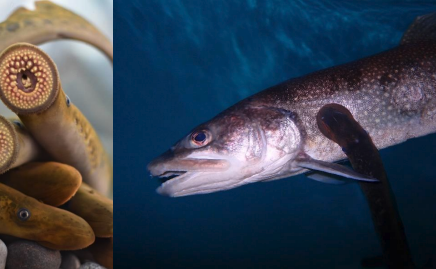
Sea Lamprey Control Initiative Enters Five-year Implementation Phase
The Supplemental Sea Lamprey Control Initiative (SUPCON) has entered a new, five-year implementation phase following several years of successful proof-of-concept research. Funded by the Great Lakes Fishery Commission, SUPCON expands... Read More
Alliance for the Great Lakes Addresses the Impact of Data Centers
The Alliance for the Great Lakes (AGL), a nonpartisan, nonprofit organization that works to protect, conserve and restore the Great Lakes, is investigating the impact of data centers and agricultural... Read More

