
New Water Standards: Updating International Great Lakes Datums to Reflect Lake Bottom Rebound
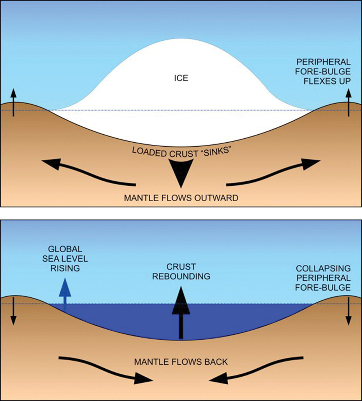
As the National Oceans and Atmospheric Administration (NOAA) puts it, the massive weight and movement of the mile-thick Laurentide ice sheet “gouged out the earth to form the lakes’ basins.” As the glacier melted, the deepened areas filled with water, becoming lakes.
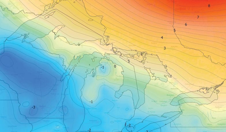
Rebounding throughout North America and the Great Lakes/St. Lawrence Seaway region is occurring gradually – and to a greater extent in the Upper Lakes. For example, in one 30-year period, measurements showed a 12-inch rise in the lakebed of Lake Superior.
As a result, U.S. and Canadian government representatives from a variety of agencies assemble about every 30 years to measure and update the International Great Lakes Datum (IGLD). The 2020 update – the first since 1985 – is underway.
“Were on schedule to produce that next update,” says John Allis, Chief, Great Lakes Hydraulics and Hydrology Office, U.S. Army Corps of Engineers. “We expect to release it in 2025.”
Allis is working with the coordinating committee on Great Lakes Basic Hydraulic & Hydrologic Data, the formal name of the binational group. Committee leadership is provided by NOAA for the U.S. and the Canadian Hydrographic Service.
The regional adjustments in the earth’s crust differ because of the early variations in glacial thickness, movement and melting, according to Terese Herron, a hydrographer with Fisheries and Oceans Canada who answered questions with assistance from representatives of the coordinating committee.
Taking Measurements
The new IGLD datum will, for the first time, be set using state-of-the-art equipment which measures more accurately and faster. It also creates modeling that sets benchmarks. The technology includes use of satellite systems, like GPS.
On the ground, the committee is collecting data from permanent and temporary water level gauges. In the Great Lakes region, more than 200 permanent and seasonal gauges – in U.S. and Canadian waters – are being used to gather data.
“These will densify the water level measurement network in an effort to determine the variations in the surfaces of each of the Great Lakes,” according to the committee.
In 1955 and 1985, the IGLD was determined by people physically traveling around the Lakes and using poles and levels. It was expensive and time consuming. Leveling is susceptible to more errors than the new modeling, which allows for detailing down to centimeters.
The new survey techniques will collect data in about six weeks instead of years and millions of dollars spent on crews manually moving about the basin. This time, preparation coincides with the binational effort to update datum throughout North America.
Commercial Impacts
The greatest impact on regional shipping will be changes to Low Water Datum (LWD), which is included in this round of updates. The chart datum impacts federally authorized depths and the depths shown on navigation charts of the Great Lakes, connecting channels and St. Lawrence River system. In the Lakes, it also impacts authorization for harbor improvements.
LWD was established in 1933 using data from the 1800s. While the datum was proportionally shifted in 1955 and 1985, the historical record of water levels has not been reviewed in context since 1933.
Essentially the LWD – not water levels – determines the depth ships have for sailing. It’s the reference point the Corps uses for maintenance.
“The LWD is going to be updated by looking at the historical record through current and recalculated data to see if the current plan still makes sense,” Allis says. “It will directly impact how much water shippers will have available.”
The new IGLD will in some way address concerns about climate change and outflow regulations for the lakes. Water levels have swung from drastically low, causing ships to light-load, to flooding shorelines along the St. Lawrence River. At times, the vast shifts have resulted in negative news about the industry and misunderstandings of how binational outflow plans work.
Releasing the new datum in 2025 will ensure current and more accurate standards.
“The committee wants to make sure they’re capturing the current water levels,” Allis says, “and to make sure shippers have the depths they need.”
The Corps will continue to dredge to the federally authorized depth of 27 feet. How much dredging will be required is yet to be determined.
Expectations are that LWD will change little, if at all, in Lakes Erie and Ontario. For the Upper Lakes, however, the shift could mean dropping the datum as much as a foot. Such a shift would mean some harbors will require that extra foot be dredged to maintain the approved commercial depth.


Dredging Operations Underway in Rocky River Harbor
The U.S. Army Corps of Engineers (Corps), Buffalo District, has launched a major maintenance dredging project at Rocky River Harbor aimed at ensuring safe navigation for recreational boaters and other... Read More
The Critical Need for Another Great Lakes Icebreaker
Icebreakers are complex vessels — almost as complex as the politics required to construct them. For Great Lakes shipping, icebreaker capabilities and readiness were particularly critical because of this winter’s severe conditions. Consider that the... Read More